


A number of districts in Afghanistan’s Badakhshan Province have been affected by a series of mudslides and floods caused by recent heavy snowfalls.
Citing Humayun Dehqan, the head of the Badakhshan emergency management agency, Ferghana news reported on February 19 that roads leading to 19 districts of the province have been blocked and they cannot provide assistance to residents of those districts because of ongoing mudslides and floods.
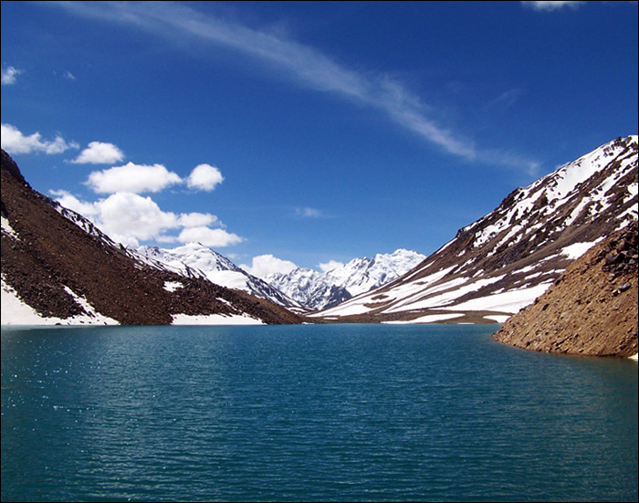
Afghan emergency management officials say floods have been caused by filtration of water from Lake Sarez in Tajikistan’s Gorno-Badakhshan Autonomous Region (GBAO).
Meanwhile, Rustam Nazarzoda, the head of the Committee for Emergency Situations and Civil Defense under the Government of Tajikistan, told reporters in Dushanbe on February 6 that the current state of Sarez Lake Dam does not cause concern.
Lake Sarez is a lake in GBAO’s Rushan district. Length is about 75.8 kilometers (47.1 mi), depth is few hundred meters, water surface elevation is about 3,263 meters above sea level and volume of water is more than 16 cubic kilometers. The mountains around rise more than 2,300 meters above the lake level.
The lake formed in 1911, after a great earthquake, when the Murgab River was blocked by a big landslide. The landslide dam formed by the earthquake is known as the Usoi Dam, which is 3km long and 550m high, the tallest natural dam in the world.
A landslide reportedly caused two meter high waves in the lake in 1968. A 1997 conference in Dushanbe concluded that the dam was unstable and might collapse if there were another powerful earthquake.
In 2000, the Lake Sarez Risk Mitigation Project (LSRMP) was launched. The project aiming at reducing the risk related to the natural structure by implementing a monitoring and an early warning system, by training the population leaving downstream and developing long term solutions, is a partnership between the Government and the people of Tajikistan, the World Bank and the donor community represented by the Swiss State Secretariat for Economic Affairs (SECO), the Aga Khan Foundation (AKF), and the United States Agency for International Development (USAID). The main Tajik counterpart for the project is the Committee for Emergency Situations (CES).
A 2004 study by the World Bank held that the dam was stable. The principal danger seems to be a partially detached mass of rock of about 3 cubic kilometers that could break loose and fall into the lake. Since the valley below the dam is so narrow, any flood would be very destructive.